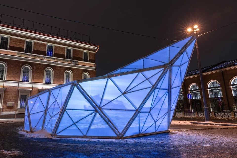
DROPS is an audiovisual data-driven installation, created in collaboration with Baraga Studio. It visualizes and sonifies one of the most urgent transformations of our time: the melting of glacial ice.
This work explores how data can become poetic material. Each drop represents a portion of melted ice. Together, these digital elements compose a temporal artwork—a sonic and visual metaphor for climate acceleration.
Turning Data into Urgency
The installation unfolds across time: years, months, days. As it moves forward, the rhythm of the drops increases. This acceleration mirrors the rapidly growing volume of ice lost from Earth’s glaciers.
To give scale:
Every second, approximately 3 million tons of ice melt into the sea.
That equals 259 billion tons per day.
Between 1992 and 2017, Antarctica alone lost 2658 gigatons of ice. This contributed to a 7 mm rise in global sea levels. Notably, nearly 75% of this occurred in the last 10 years of that period.
Artistic Mechanics and Sound Structure
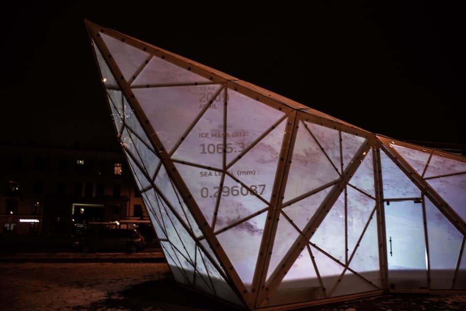
In DROPS, every new drop corresponds to 0.1 mm of sea level rise. Each is rendered visually and sonically. As the sea rises, so does the density of sound—culminating in a final crescendo of 74 drops symbolizing 7.4 mm.
Each drop’s appearance is based on IMBIE satellite data, supported by ESA and NASA, using a mix of altimetry, gravimetry, and input-output methods. The piece thus combines scientific precision with immersive audiovisual composition.
A Reminder Through Form
By transforming this scientific data into a ritual of disappearing matter, DROPS invites us to listen differently—to engage emotionally with the reality of climate collapse.